SOLUTIONS
Discover the solutions which make Tomahawk Maps a crucial aid in achieving enrolment and retention success.
STUDENT LOCATIONS
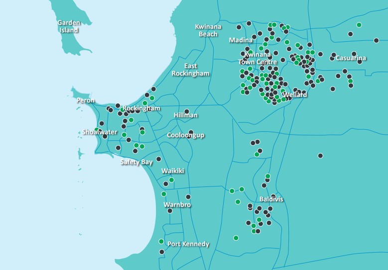
Unleash your data by mapping student locations
In the past schools relied on spreadsheets, reports in lever arch files, and pin-laden wall maps to visualise student locations. Now, thanks to Tomahawk Maps’ sophisticated digital mapping platform, this information is a few mouse clicks away on a computer screen.
Once you provide us with your student location data, we will plot this information on our geo-mapping platform allowing you to build a picture of where they live. Our platform makes it easy for you to access your past, present and future enrolment numbers, identify student location ‘hotspots’ through specialised heat-maps, and breakdown this information into year groups.
Our platform is safe and secure. We do not record or display student names or other identifiable information. Home addresses are converted into longitude and latitude coordinates allowing you to securely see where your students live while maintaining their privacy and safety.
COMPETITOR DATA
ACARA schools profiling data at the end of a mouse
In the competitive world of fee-paying education, it is important to stay up-to-date with how your school compares with rivals.
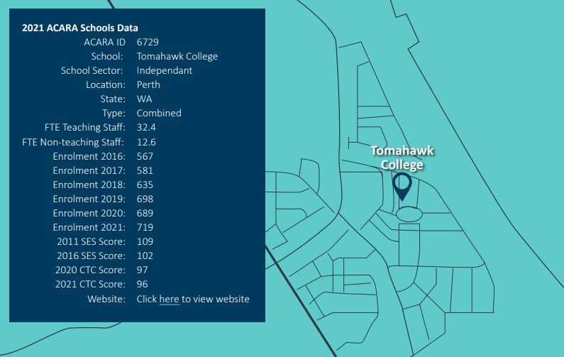
Tomahawk Maps makes this possible by displaying the locations of all Australian schools and colour-coding the information according to school category.
Select an individual school location to see the latest ACARA profiling data including staff numbers, enrolment trends and government funding scores.
Further refine this by plotting an area around your school to hone-in on your nearest competitors, while accessing aerial photography to see how infrastructure at nearby schools has changed over time.
You can view this information alongside population and demographic Census data readily available on our platform.
BUS ROUTES
Plan bus routes to make life easier for students and parents
Transport is a key consideration of parents when choosing a school for their children. With increasingly busy professional lives, parents are less able to commit to undertaking school drop-offs and pick-ups and value the efforts by schools to assist with transport.
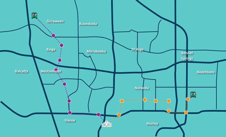
Make your school more attractive to prospective families by using Tomahawk Maps to plan convenient bus routes.
Use the platform to identify public transport options in your local area and compare these to student residential locations. You will soon identify gaps which can be filled by new bus routes.
CENSUS DATA
Easily access Census data to plan for the future
Tomahawk Maps provides you with the population and demographic information you need to devise effective marketing campaigns.
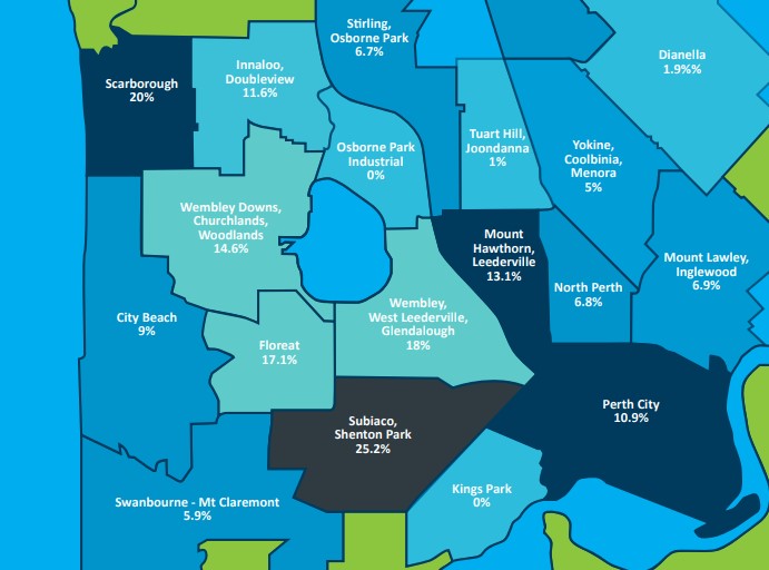
We overlay the latest ABS data over maps of your catchment areas helping you to build a picture of where prospective students are located.
This data includes:
• Census population figures that can be broken down into age groups allowing you to forecast school enrolment numbers from different areas.
• Weekly household income statistics giving you an insight into how affordable your school fees are to local families.
• Home dwelling approval figures helping you to determine where your next areas of demand may be.
• What type of schools parents are choosing to send their children to (independent, Catholic, or government).
This information can be downloaded as a PDF to include in business planning reports.
 CONTACT US
Get in touch with our team to organise a free demo with us. If you have any additional questions or enquiries about Tomahawk Maps and how it can help your school, please feel free to reach out to us, and we'll get back to you shortly.
(08) 9384 3460
8/355 Stirling Hwy, Claremont WA 6010
